# Spatial reference systems
# What is a spatial reference system?
A spatial reference system (SRS) or coordinate reference system (CRS) is a coordinate-based local, regional or global system used to locate geographical entities. A spatial reference system defines a map projection, as well as transformations between different spatial reference systems.
# Understanding map projections
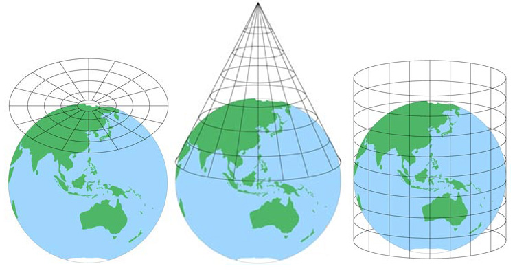
A map projection is how we represent the curved ellipsoidal Earth surface onto a flat surface - from three-dimensions to two-dimensions. It is a well known topic when presenting geographical entities. There are many different map projections, such as Mercator (opens new window), Robinson (opens new window), and Van der Grinten (opens new window) to name a few. Each projection distorts the three-dimensional surface slightly differently.
Civillo converts each layer's data into the Web Mercator Projection (opens new window), which is a variant of the Mercator projection and is used primarily in Web-based mapping programs. To complete this conversion, Civillo needs to know how the incoming data is projected so that it can perform the correct conversion process.
A list of spatial reference systems can be found at www.spatialreference.org (opens new window)
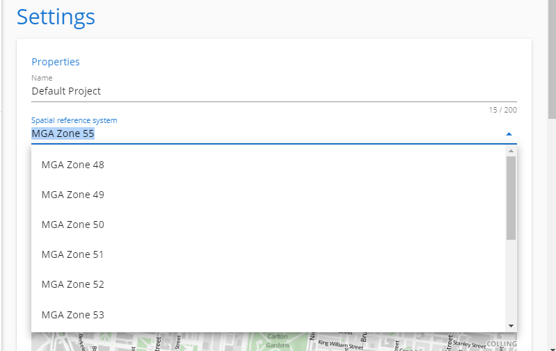
# Assigning a project spatial reference system
Civillo should have a default spatial reference system. This is set when the project is created.
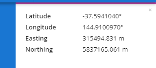
Users can see this spatial reference system in the feature identify tool.