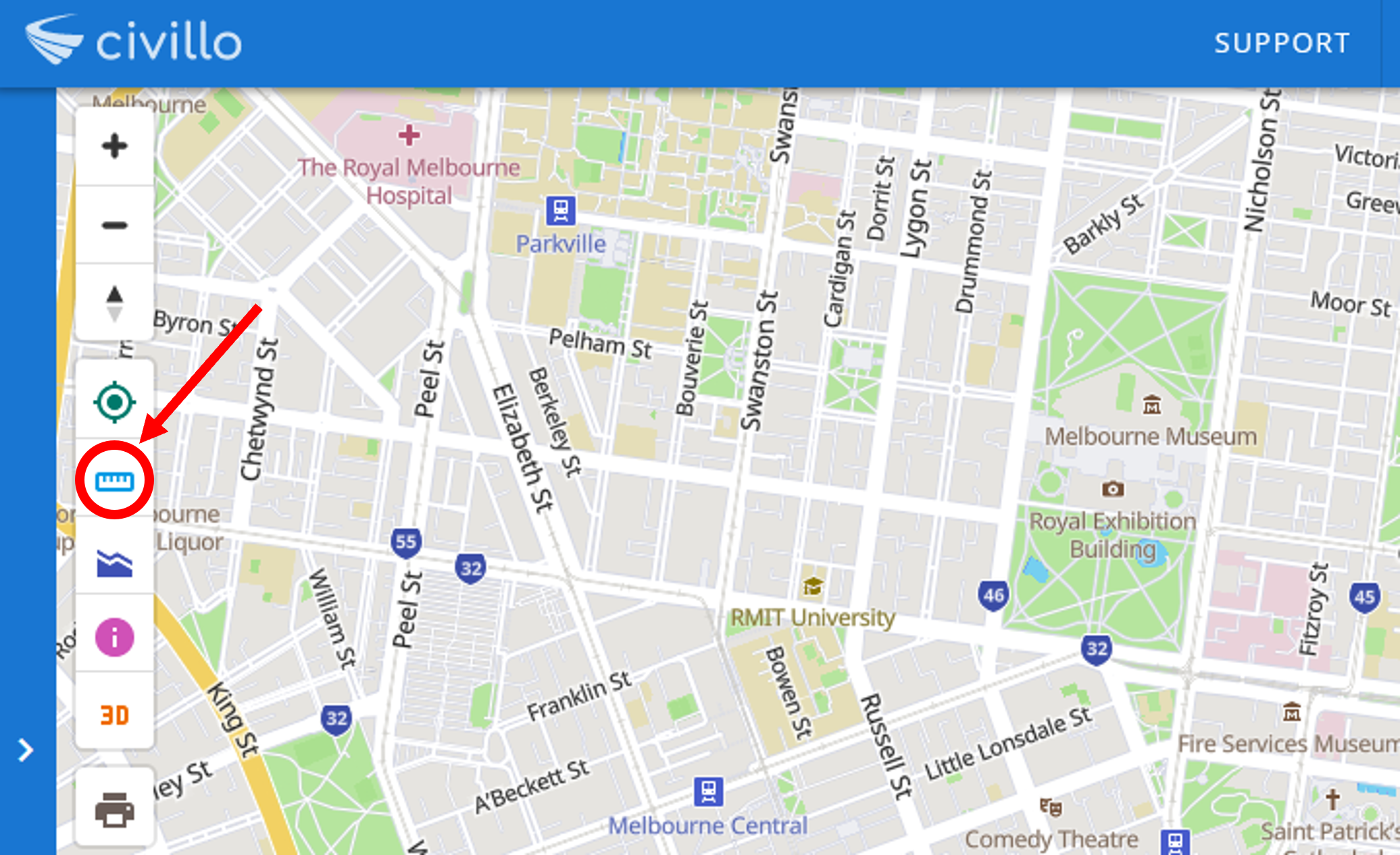
# Measure tool
The measure tool can be used to measure perimeters and areas between points on the map.
# New measurement
To create a new measurement, select the measure tool in the map screen.
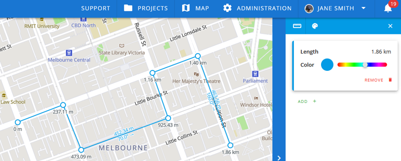
# Measure perimeters
By clicking on the map screen, you create a new point. Create a line or polyline by adding more points. The associated length will appear in the alternate bar on the right.
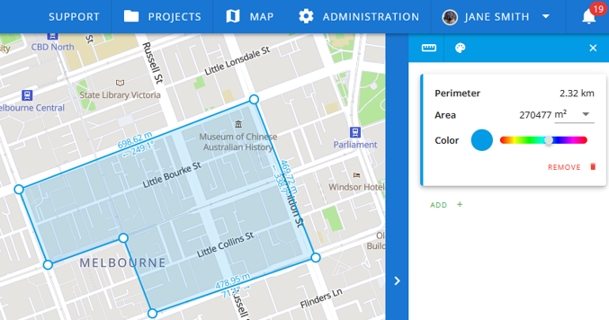
# Measure areas
To measure an area, create a polygon by joining the last point to the first point in the shape. The area between points will be shaded in blue on the map and the area measurement will appear in the sidebar.
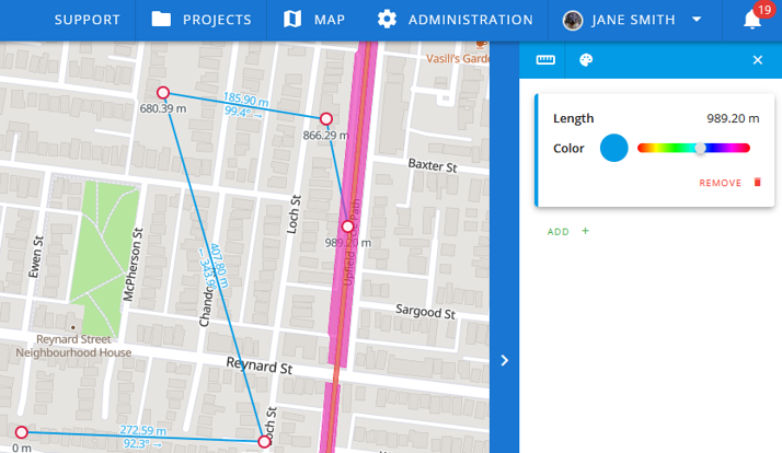
# Measurement between features
You can calculate the distance or area between features by selecting the features of a layer as points with the measurement tool. Measurement points situated on features will always appear as red dots.
# Clear measurement
Start a new measurement by clicking Clear all then selecting your new points.
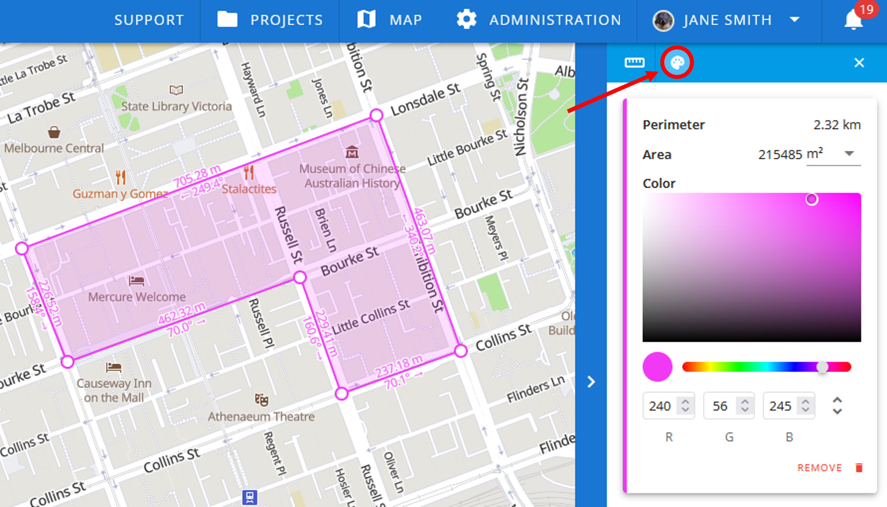
# Change measurement color
Customize the color of each measurement by dragging the associated color bar. To view more color options, click the palette icon at the top of the alternate bar marked below.
Each measure card will expand to include a canvas and RGB inputs for further customizing color. The arrows on the right toggle between RGB, HSL and hex color inputs.
# Measurement tool in 3D mode
The measurement tool can be utilized in 3D mode to measure within and between features. Measure points can only be added on top of features. When dragging a point on the map its location will snap to that of the nearest feature.
The measure card in the alternate bar will include 3D, geodesic and vertical separation length. As shown below the 3D lengths will be displayed with solid lines and the geodesic (horizontal) and vertical lengths with dashed lines.
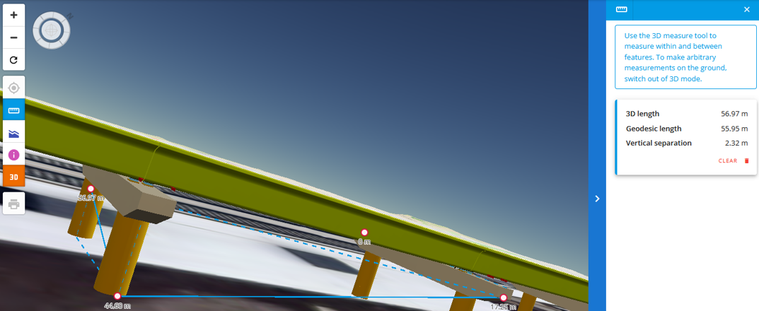
In 3D mode, arbitrary measurements on the ground cannot be made. To make such measurements please return to 2D mode and re-select the measure tool.
# Exit measurement tool
Exit the measurement tool by clicking the cross in the top right corner of the alternate bar.
Note that this will clear all current measurements you have made.
← Query features Print →