# Add an online imagery layer to Civillo
Web Map Service (WMS), Web Map Tile Service (WMTS), or Tile Map Service (TMS) provide the ability to visualize geographic data by using standard (or otherwise) protocols for serving geo-referenced map images over the Internet.
These data sources can be added to your Civillo project as online imagery layers.
# Creating a new online imagery layer
- Open your project.
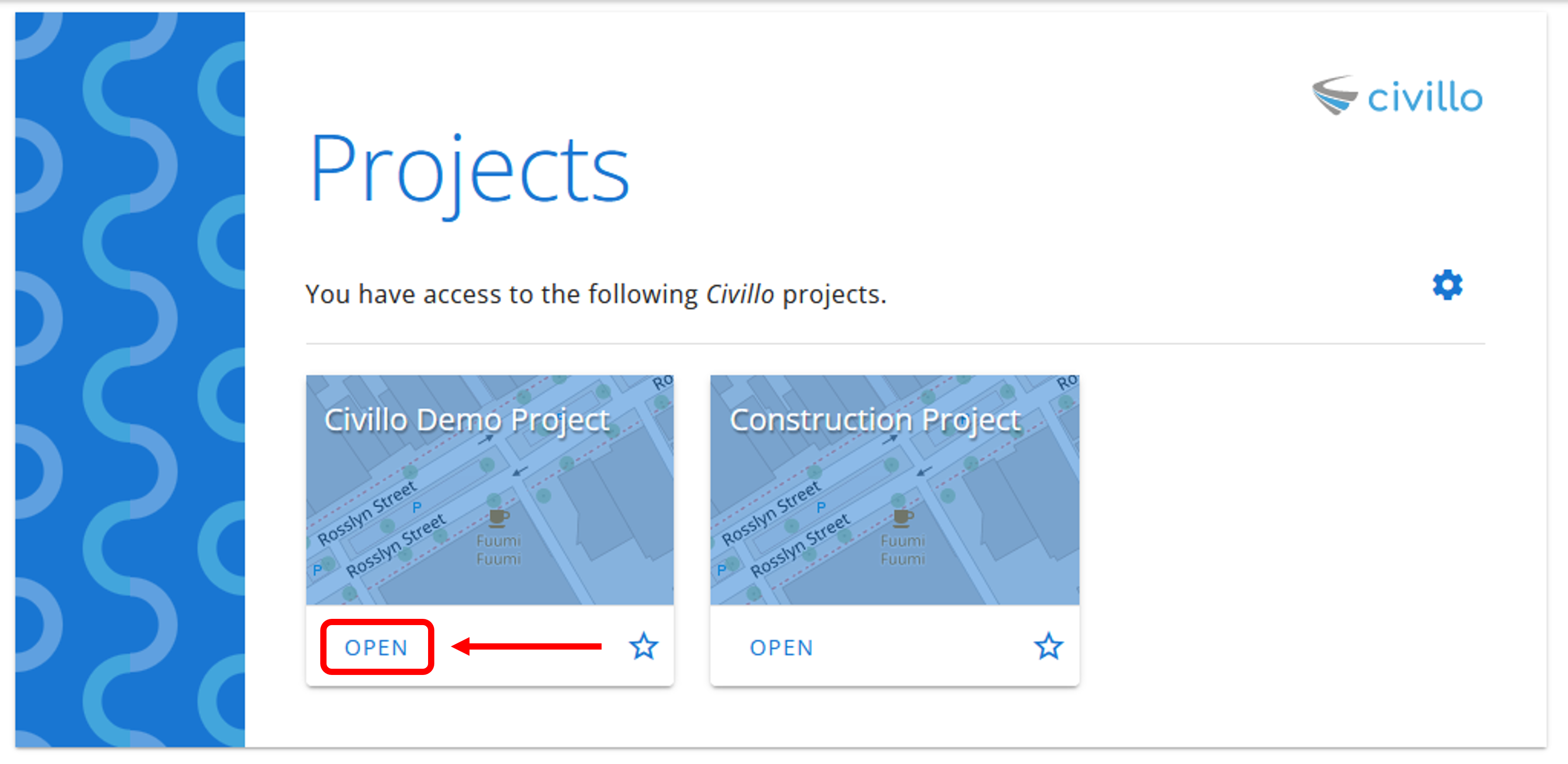
- From the navigation bar, click Administration.

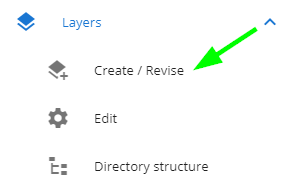
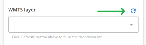
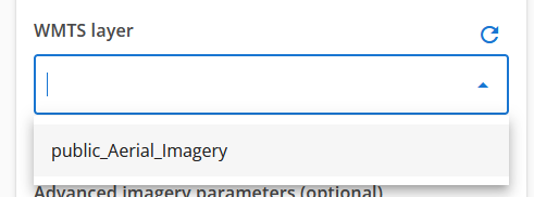
- In the left sidebar, under your project's name, click Layers and then click Create / Revise.
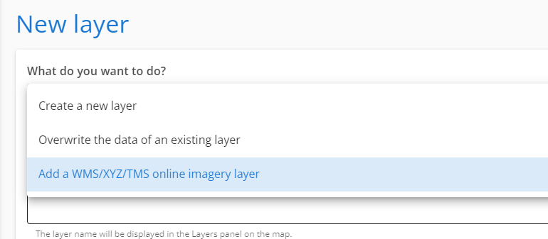
- Select the WMS/WMTS/XYZ/TMS online imagery layer
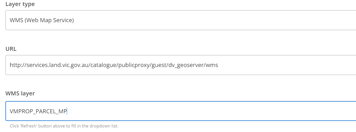
Give the layer a name.
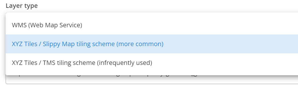
Under Layer type select either:
# Add additional parameters to the online service layer (optional)
Online imagery services such as WMS, WMTS or XYZ slippy maps use zoom levels to describe the level of detail visible within the map. They are expressed as a number, with higher numbers representing higher resolutions (such as 21, which represents 0.074 metres per pixel) and lower numbers representing lower resolutions (such as 9, which represents approximately 300 metres per pixel).
When adding an online imagery service layer, optional parameters are available to the layer creation.
- Min zoom - the minimum zoom level the layer should be visible. Default values this should be between 10 to 14 based on the source data.
- Max zoom - the maximum zoom level the layer should be visible. If set, this should be around a value of 18, however some higher resolution datasets can be set to 20.
- Tile size - the size of the images (the tiles) used in the online service. The tiles are usually 256x256 pixels and are used to store and serve map data. TMS tiles are typically stored as PNG or JPG images. The default value should be 256.
# Add Nearmap WMS imagery
A source of up to date aerial imagery can be provided by Nearmap (opens new window).
The Nearmap API services allow users to load high-resolution imagery on demand for Civillo projects.
To learn about how to create a Nearmap Web web-service in Civillo, please refer to the Nearmap WMS Integration.
# Common WMS online sources
There are a number of organizations and companies that serve Australian WMS maps. These include Geoscience Australia, which offers a range of maps and GIS data for the country, as well as individual State Government departments, each who offer a range of WMS maps.
| Source | URL |
|---|---|
| Victorian Government WMS server | https://opendata.maps.vic.gov.au/geoserver/ows?service=WMS&request=getCapabilities (opens new window) |
| NSW Geoscientific Data Warehouse | https://gs.geoscience.nsw.gov.au/geoserver/ows?service=wms&version=1.3.0&request=GetCapabilities (opens new window) |
| Geoscience Australia | https://gaservices.ga.gov.au/ (opens new window) |
| Digital Earth Australia | https://ows.dea.ga.gov.au/ (opens new window) |
# Common XYZ Tiles online sources
| Source | URL |
|---|---|
| ESRI World Satellite imagery | https://services.arcgisonline.com/arcgis/rest/services/World_Imagery/MapServer/tile/{z}/{y}/{x} |
| Open Street Map tiles | https://tile.openstreetmap.org/{z}/{x}/{y}.png |