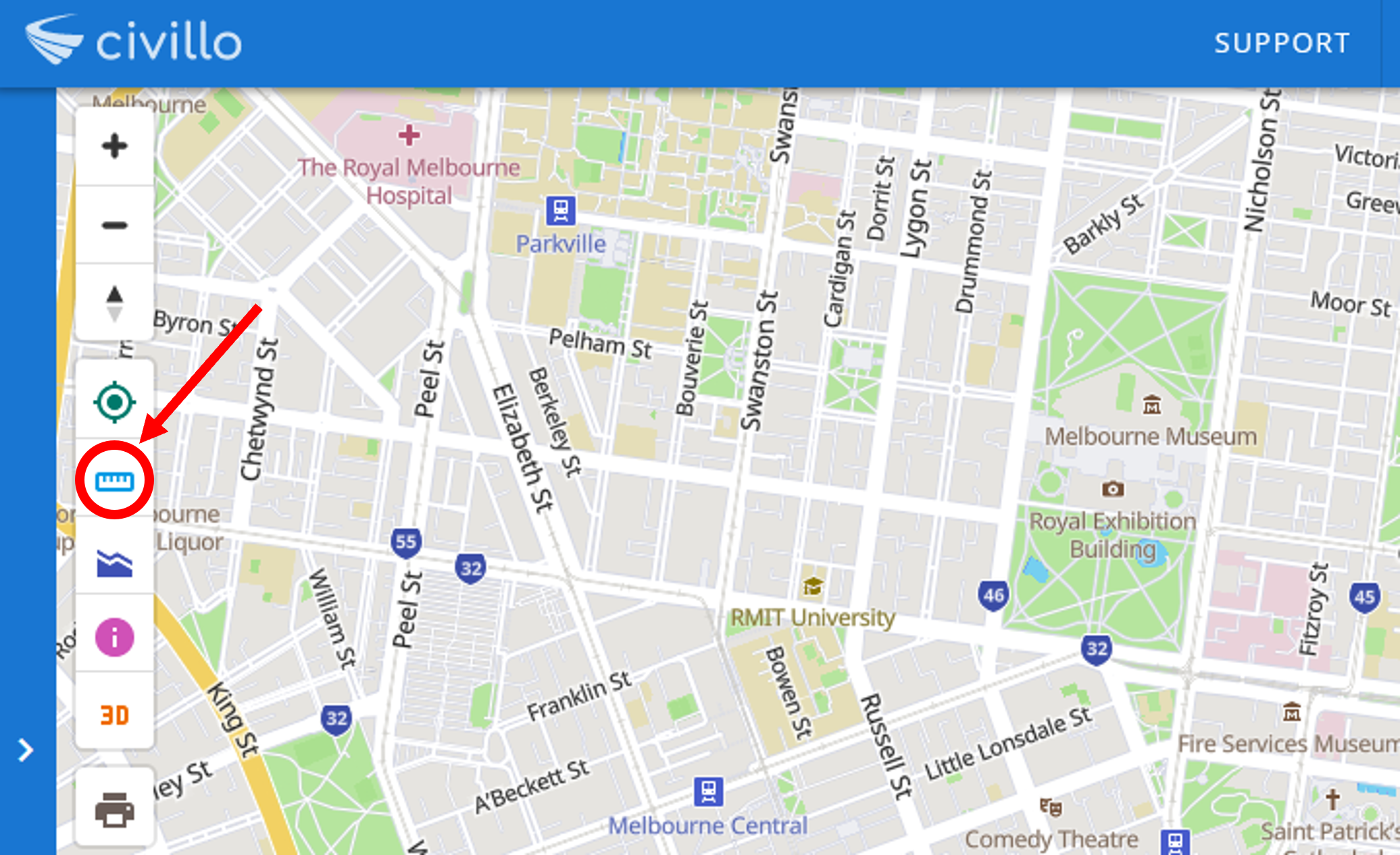
# Use the measure tool
The measure tool can be used to measure perimeters and areas between points on the map.
# New measurement
To create a new measurement, select the measure tool in the map screen.
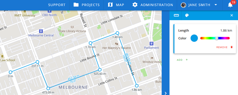
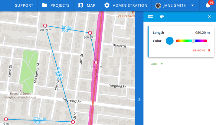
# Measure perimeters
By clicking on the map screen, you create a new point. Create a line or polyline by adding more points. The associated perimeter will appear in the alternate bar on the right.
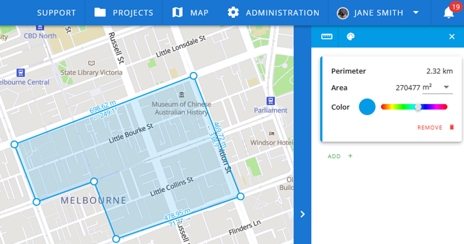
# Measure areas
To measure an area, create a polygon by joining the last point to the first point in the shape. The area between points will be shaded in blue on the map and the area measurement will appear in the sidebar.
# Measurement between features
You can calculate the distance or area between features by selecting the features of a layer as points with the measurement tool.
# Clear measurement
Start a new measurement by clicking ![]() and selecting your new points.
and selecting your new points.
# Exit measurement tool
Exit the measurement tool by clicking the ![]() in the top right corner of the alternate bar.
in the top right corner of the alternate bar.